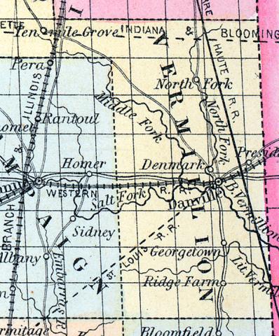
VERMILION COUNTY, situated on the east boundary of Illinois. Area, 1,000 square miles. Face of the country, level; soil, rich. Seat of justice, Danville. Pop. in 1830, 5,836; in 1840, 9,303; in 1850, 11,492. (Fanning's, 1853)
VERMILION COUNTY A county in the east part of the state, bordering on Indiana, has an area estimated at 1,200 square miles. It is drained by the Vermilion river, an affluent of the Wabash, and by its branches, the south, middle and north forks, which unite near the middle of the county. The Little Vermilion river flows through the southerly part.
The surface is generally level; the soil is deep, fertile and durable. The county contains a large proportion of prairie, with plenty of timber distributed along the streams.
Indian corn, wheat, oats, wool, butter, potatoes and pork, are the staples. It contains 30 churches, two newspaper offices, 100 pupils attending public schools, and over 200 attending an academy. A plank road connects Danville with the Wabash river and canal. Vermilion river affords valuable water power. Stone coal is found in abundance on the bank of the river. Capital, Danville. Population, 11,500. (Hawes' Illinois State Gazetteer...,1859)

