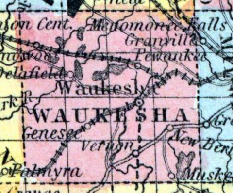
WAUKESHA COUNTY, situated in the southeast part of Wisconsin. Area, -------- square miles. Seat of justice, Waukesha. Pop. in 1850, 19,248. (Fanning's, 1853)
WAUKESHA, a county in the S. E. part of Wisconsin, contains 576 square miles. It is drained by the Pishtaka or Fox river, and by the Bark river, both of which rise within its borders; and it is sprinkled with numerous small lakes, none of which is above 4 miles in length. The surface is undulating; the soil is calcareous and highly productive. The greater part of the county consists of prairies and oak-openings. Wheat, oats, barley, potatoes, and butter are the staples. The produce of the county in 1850 was 812,658 bushels of wheat; 248,392 of oats; 119,154 of potatoes; 317,649 pounds of butter, and 52,369 bushels of barley, (the greatest quantity raised in any county in the United States.) It contained 19 churches, 1 newspaper office, 5435 pupils attending public schools, and 156 attending academies and other schools. The rock which is found near the surface is the blue limestone, an excellent building material. The county is traversed by the Milwaukee and Mississippi and the Milwaukee and La Crosse railroads, and by numerous plank-roads. Capital, Waukesha. Population, 19,258. (Baldwin's New and Complete Gazetteer of the United States..., 1854)
WAUKESHA, County, is bounded on the north by Dodge and Washington, on the east by Milwaukee, on the south by Walworth and Racine, on the west by Jefferson, and is 24 miles square. It was set off from Milwaukee and fully organized January 31, 1846. The eastern portion of the county is heavily timbered, while the western is divided between oak openings, prairie and marsh. The soil is good and well adapted to tillage and grazing. The county is distinguished for its numerous and beautiful lakes, there being probably more than 30 within its limits. It is watered by the Fox, (Pishtaka), Menomonee, Ashippin and Bark rivers, and Oconomowoc, Scupernong, Poplar, White and Mukwonago creeks. Population in 1846 was 13,793; 1847, 15,866; 1850, 19,324. It has 2,561 dwellings, 1,743 farms, and 78 manufactories. The county of Waukesha is in the first congressional district and the second judicial circuit, and its legislative representation is as follows: Ninth senate district, towns of Oconomowoc, Merton, Lisbon, Summit, Menomonee, Delafield, Pewaukee, and Brookfield. Tenth senate district, towns of Ottawa, Genesee, Waukesha, New Berlin, Muskego, Vernon, Mukwonago and Eagle. The assembly districts are as follows: 1st. towns of Merton, Delafield, Summit and Oconomowoc. 2nd. towns of Pewaukee, Lisbon, Menomonee and Brookfield. 3d. towns of Ottawa, Genesee, Mukwonago and Eagle. 4th. towns of Waukesha, Vernon, Muskego and New Berlin. County Officers for 1853 and 1854: Judge, Martin Field; Clerk of Court, Lemuel White; Register, William E. Williams; Sheriff, Charles B. Ellis; Clerk of Board of Supervisors, Benjamin E. Clark; District Attorney, John E. Gallagher; Surveyor, John O.Reedsburg. (John Warren Hunt, Wisconsin Gazetteer..., Madison, 1853)

