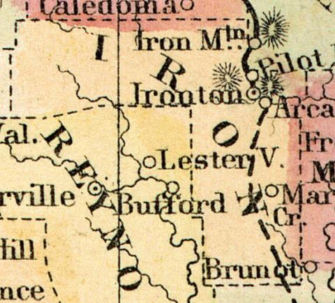
Formed in 1857 from portions of Madison, Reynolds, St. Francois, Washington and Wayne counties.
IRON COUNTY. This county is situated in the southeast portion of the State, bounded on the east by St. Francois and Madison, on the west by Reynolds, Dent, and Crawford, on the north by Washington and St. Francois, and on the south by Reynolds and Wayne Counties. Population of the county in 1860, 5723. Total value of taxable property, as assessed, $10,756. The increase during the year 1859 was $206,025, on the following items: Increase in value of mills and furnaces, $24,705; lands, $17,829; town lots, $134,308; notes and bonds, $18,463; money on hand, $1428; personal property, $9292; decrease in slaves, 14; total value of the 226 slaves in county, $98,350.
Physical Features.—The principal portion of this county is broken and mountainous, and much of the land unfit for cultivation, but generally heavily timbered with oaks, hickories, elm, ash, black walnut, hackberry, locust, red cedar, and yellow pine. The Arcadia Valley is a beautiful and fertile tract of land, well watered, having a good supply of timber, and soil adapted to all farming purposes. Some of the best farmers and fruit growers in Southeast Missouri have farms that now produce well, although they have been bearing crops for more twenty "years past. Those wonderful formations, Pilot Knob, Shepherd Mountain, Arcadia Mountain, and Bogy Mountain, each of which contains immense deposits of iron ore, are in this county.
Minerals—Pilot Knob—The Furnaces, etc.—This is emphatically the Iron County of the Union, possessing probably a greater quantity of iron ores, of purer qualities, than the same area of territory anywhere else on the face of the globe. Hence the appropriateness of the name given the county by its projector, Hon. James Lindsay. Pilot Knob is a cone-shaped hill, rising in a valley to a height of 581 feet above the bloomery at its base. Owing to its height, isolation, and prominent position, it is seen in some directions for a great distance, and having served as a landmark to hunters and travelers,
Iron County was organized by an act approved February 17, 1857. The honor of getting the bill in shape, and securing the formation of the county, is due to Hon. James Lindsay, for a number of years a member of the Legislature, and the editor of the "Ironton Furnace."
Industrial Pursuits.—There are in Iron County 3 newspapers— the Ironton Register and Arcadia Prospect, weekly, and Ironton Baptist Journal, semi-monthly—15 merchants, 12 grocers, 4 bakers, 2 confectioneries, 13 liquor saloons, 3 drug stores, 4 physicians, 1 dentist, 6 lawyers, 3 land agencies, 3 tin and stove stores, 4 boot and shoe shops, 2 saddlers, 4 tailors, 1 silversmith, 14 carpenter shops, 2 cabinet shops, 3 painters, 9 plasterers, 6 stone and brick masons, 2 livery stables, 3 blacksmith and wagon shops, 4 butcher shops, 1 High School, 1 brewery, 6 hotels, 1 Masonic Lodge, 1 Odd Fellows' Lodge, 1 Good Templars' Lodge, 7 district schools, and 6 church organizations. (Parker's Missouri as it is in 1867..., 1867)

