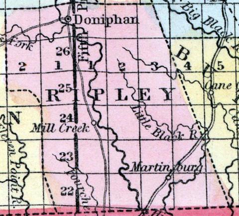
RIPLEY COUNTY, situated on the south boundary of Missouri. Area, 1,080 square miles. Seat of justice, Doniphan. Pop. in 1840, 2,856; in 1850, 2,830. (Fanning's, 1853)
RIPLEY, a county in the S. S. E. part of Missouri, bordering on Arkansas, has an area of 990 square miles. It is traversed from N. to 8. by Current river, and also drained by Little Black river, Fourche, Dumas, and Davis's creek. The surface is uneven and hilly; the soil near the streams is moderately fertile. Indian corn, oats, butter, and pork are the staples. Lumber is an article of export. In 1850 this county produced 115,241 bushels of corn; 8603 of oats, and 24,225 pounds of butter. It contained 2 churches, 20 pupils attending a public school, and 75 attending other schools. The highlands produce yellow-pine timber. Capital, Doniphan. Population, 2830; of whom 2744 were free, and 80, slaves. (Baldwin's New and Complete Gazetteer of the United States..., 1854)

