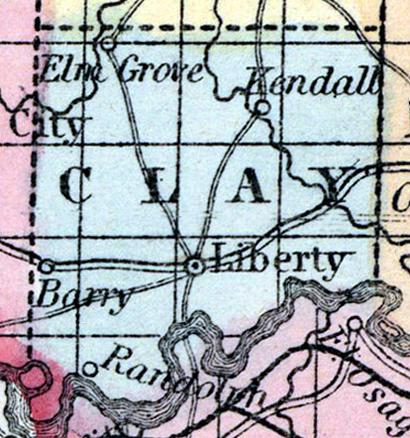
CLAY COUNTY, situated in the westerly part of Missouri, on the north side of Missouri river. Area, 432 square miles. Seat of justice, Liberty. Pop. in 1830, 5,338; in 1840, 8,282; in 1850, 10,332. (Fanning's, 1853)
CLAY, a county in the W. N. W. part of Missouri, has an area of 415 square miles. The Missouri river forms its S. boundary, it is also drained by Fishing creek and Smith's fork of Little Platte river. The surface is moderately diversified ; the soil is fertile, and well timbered with oaks, black walnut, and ash. Indian corn, wheat, oats, hemp, cattle, horses, and swine are the staples. In 1850 this county produced 834,830 bushels of corn; 50,890 of wheat; 112,027 of oats, and 12880 tons of hemp. It contained 19 churches, and 1 newspaper office. There were 780 pupils attending public schools, and 70 attending an academy. The rocks which underlie the county are limestone and sandstone. Missouri river is navigated by steamboats along the border of the county. Capital, Liberty. Population, 10,332, of whom 7590 were free, and 2742, slaves. (Baldwin & Thomas, A New and Complete Gazetteer of the United States ... 1854)

