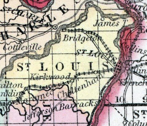
SAINT LOUIS COUNTY, situated on the easterly boundary of Missouri, with Mississippi river on the east, the Missouri on the northwest, and the Maramec on the south. Area, 550 square miles. Face of the country, even; soil, fertile. Seat of justice, Saint Louis. Pop. in 1810, 6,567; in 1820, 10,049; in 1830, 14,125; in 1840, 35,079; in 1850, 104,978. (Fanning's, 1853)
ST. LOUIS, a county in the E. part of Missouri, occupies a point of land formed by the confluence of the Missouri with the Mississippi river, the latter of which separates it from Illinois on the E. The Maramec river traverses the southern part, and enters the Mississippi on the boundary of this county. It is also drained by River des Peres, and by Gravois and Bonhomme creeks. The surface is pleasantly diversified ; the soil has a sub- stratum of good limestone, and is highly productive. Indian corn, wheat, oats, hay, butter, and pork are the staples. In 1850 the county produced 668,210 bushels of corn ; 98,430 of wheat; 1.38,837 of oats; 14,169 tons of hay, and 203,482 pounds of butter. The produce of hay was greater than that of any other county in the state. It contained 53 churches, 31 newspaper offices; 2514 pupils attending public schools, and 3992 attending academies and other schools. Extensive mines of stone coal and quarries of marble are worked, and iron is found in the W. part. Several railways are in progress of construction through the county. This is by far the most populous and wealthy county in the state. Capital, St. Louis. Pop., 99,978; of whom 94,011 were free, and 5967, slaves. (Baldwin & Thomas, A New and Complete Gazetteer of the United States ... 1854)

