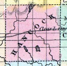
CLEAR LAKE, is situated on a beautiful lake of the same name, 10 miles west of Mason City. It has two churches, Methodist and Congregational, also, Benevolence Lodge, No. 145, A. F. & A. M. There are here two saw mills; one general store; and one grocery. Population about 150.
All States // Missouri // Illinois // Iowa
Displaying 101 - 150 of 1183
State: Iowa
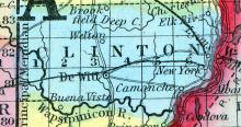
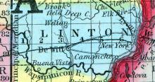
CLINTON, county, Iowa Ter. Situated in the N. part of the ter., having the Mississippi r. for its E. boundary. Drained by Wabesipinica r. and its branches, on the s, and on the n. by Prairie cr.. Deep cr. and other branches of Macoquetais r. Capital, Camanche. There were in 1840, neat cattle 865, sheep 58, swine 2,007; wheat 5,413 bush, produced, Ind. corn 18,515, oats 3,555, potatoes 17,574; 3 stores, cap. $11,350; 2 grist m., 3 saw m. Cap. in manufac. 4,000. 1 sch.
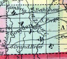
CORYDON, the county seat [Wayne County], is situated near the centre of the county, and is sixty miles from the railroad at Ottumwa, from which place a daily mail is received via the Western Stage Company. It was located in the year 1851, by George W. Perkins, Wm. Davis and Lancaster M. Boggs, Commissioners appointed by Act of the General Assembly, to establish a permanent seat of justice for Wayne County.
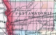
COUNCIL BLUFFS, City Of, called also KANESVILLE, a post-village and capital of Potawatomie county. Iowa, near the Missouri river, 250 miles W. of Iowa City. It has 30 or 40 stores. Pop. in 1853, 8000. (Baldwin's New and Complete Gazetteer of the United States..., 1854)
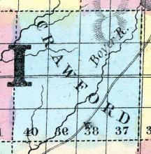
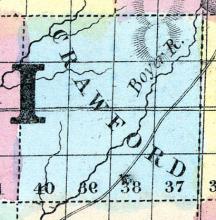
CRAWFORD, a new county in the W. part of Iowa, has an area of about 600 square miles. It is intersected by Boyer and Soldier rivers, affluents of the Missouri. The county is not included in the census of 1850, and has few inhabitants. County seat not located. (Baldwin's New and Complete Gazetteer of the United States..., 1854)
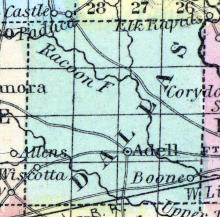
DALLAS COUNTY Was first settled by Samuel Miller and family, in 1846. The population of the county according to the last census, was 2565. The present population of Adel, the county- seat is 126. The town is beautifully located on the west side of the North Raccoon River, and is directly on the great route between the East and California, Oregon and Utah.
Five public schools in the county, all in a prosperous condition. No private schools.
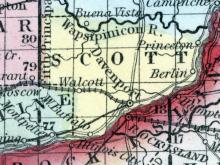
DAVENPORT, p-v, capital of Scott CO., Iowa, 350 above St. Louis, by water, 60 above Burlington. This place is pleasantly situated on the N side of the Mississippi river. (Haskell's Complete Descriptive and Statistical Gazetteer of the the United States...,1840)
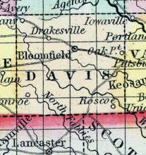
DAVIS, a county in the S. S. E. of Iowa, bordering on Missouri, has an area of 480 square miles. It is intersected by Fox river and Soap creek, and drained also by the sources of the Wyaconda and Fabius rivers, which flow south-eastward. The surface is rolling, the soil rich and well watered, but mostly destitute of timber. Indian corn, butter, and wool are the staples.
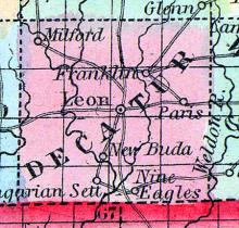
DECATUR, a county in the S. part of Iowa, bordering on Missouri, has an area of 528 square miles. It is traversed from N. to S. by the Weldon river, and by the Crooked fork of Grand river. The surface is undulating; the soil fertile. The prairies of this county are separated by numerous groves of hard timber distributed along the watercourses. Indian corn, oats, grass, and pork are the staples.
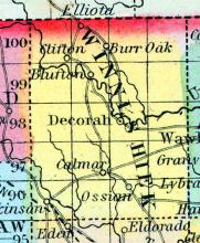
DECORAH, a small post-village, capital of Winnishiek county, Iowa, on the Upper Iowa river, 3.'! miles W. from the Mississippi river at Columbus, which is the nearest landingplace. The river furnishes water-power. (Baldwin's New and Complete Gazetteer of the United States..., 1854)
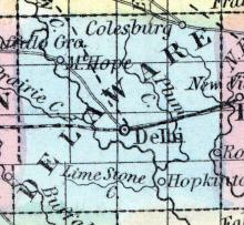
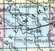
DELAWARE, county, Iowa. Situated in the N. part of the territory, and contains 576 sq. miles. Watered by Macoquetais r. and its tributaries. The surface is dry and rolling, and the soil is fertile. It abounds with excellent timber. Iron ore is found. It is attached to Dubuque co. for judicial purposes. There were in 1840, neat cattle 228, sheep 25, swine 574; wheat 450 bushels produced, bid. com 3,775, oats 690, potatoes 1,475. Pop.
DELHI, c. h., p. v., seat of justice of Delaware со., Iowa, 55 ms S. of Iowa city ; from W. 875 ms. (Fanning's, 1853)
DENISON, the county seat [Crawford County, Iowa], is situated near the centre of the county, in the forks of the Boyer River, and on the line of the Cedar Rapids and Missouri River Railroad, and is 79 miles west of Boonsboro, the present terminus of that road. It was first settled in September, 1856, by J. W. Denison, F. Reynolds, J. B. Swain, R. W. Calkins, O. S. Gates, F. W. Buescher. Jacob Whitinger, Morris McHenry, J. T. Seagrave and Eli Baer.
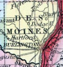
DES MOINES COUNTY, situated in the southeast part of Iowa, with Mississippi river on the east, and Chickahoma river on the southwest. Area, 410 square miles. Seat of justice, Burlington. Pop. in 1840, 6,577 ; in 1850, 12,987. (Fanning's, 1853)
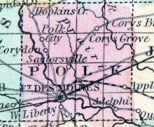
FORT DES MOINES, IA., c. h. Polk co. At the junction of Racoon and Des Moines. It is a beautiful place at the head of navigation of the Des Moines River, within 30 miles of the geographical centre of the state, of which it will probably be the capital at no distant day. The valley of the Des Moines is unsurpassed in fertility, and Fort Des Moines is already the seat of a large inland trade. 120 miles W. from Iowa City. (Gazetteer of the United States of America, 1854)
DE WITT, a small post-village, capital of Clinton county, Iowa, 70 miles E. N. E. from Iowa city, and 4 miles N. from the Wapsipinicon river. (Baldwin's New and Complete Gazetteer of the United States..., 1854)
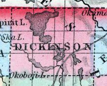
DICKINSON, a new county in the N. W. part of Iowa, bordering on Minnesota, has an area of about 430 -square miles. It is intersected by the Okoboji river, a branch of the Little Sioux river, which flows into the Missouri. It has several small lakes, the principal of which is Spirit lake. This county is not included in the census of 1850. County seat not located.
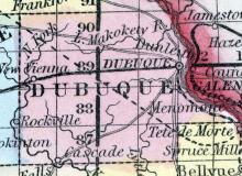
DUBUQUE, county, Iowa. Situated in the N. r. part of the ter. It has the Mississippi r. on its s. E. border. Watered on the N. bv Turkey r., on the s. by branches of the N. fork of Macoquetais r, and in the central part by Little Macoquetais river, and several small creeks, which flow into the Mississippi. Capital, Dubuque. There were in 1840, neat cattle 2,175, sheep 36, swine 4,8118; wheat 10,799 bush, produced, rye 715, Ind.
DUBUQUE, a flourishing city of Iowa, and seat of justice of Dubuque county, is situated on the right bank of the Mississippi river, about 200 miles above Burlington, 450 miles above St. Louis, and 24 miles by water from Galena. The situation of Dubuque is regarded by some persons as more beautiful than that of any other city in Iowa. It stands on a broad plateau or terrace, which extends along the river for several miles.
ELDORA is the county seat, situated on the Iowa River, on the stage route from Marshalltown to Iowa Falls. It contains two churches, Christian and Methodist; also Montague Lodge of Masons and a Lodge of I. O. O. F. There are three general stores, one drug store, one grocery, one hardware store, one saw-mill and one stone-ware pottery. The Hardin Sentinel is published weekly, by Marcus C. Woodruff. The Iowa River affords superior water power at this point.
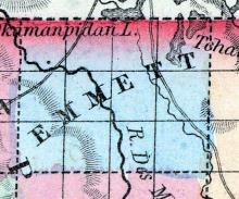
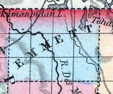
EMMETT(sic), a new county in the N. N. W. part of Iowa, bordering on Minnesota, has an area of about 450 square miles. It is intersected by the Des Moines river, and by one of its affluents flowing from Okamanpidu lake. There are several small lakes near the N. E. border of the county. Emmett county is not included in the census of 1850. County seat not located.
ESTHERVILLE is the county seat [Emmet County, Iowa], situated in the western part of the county on the Des Moines River, eighty miles northwest of Fort Dodge. It contains one Methodist church, one general store, and one saw mill. The Des Moines River affords good water-power at this point. The soil of the township is a rich sandy loam.
Population of the village, 200; of the township, 300. (Hair's Iowa State Gazetteer..., 1865)
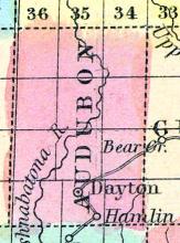
EXIRA, the county seat [Audubon County, Iowa], is situated in the southern portion of the county. It is 75 miles west of DesMoines, and 70 north-east of Council Bluffs, on Section 6, Township 78, Range 85. It contains one hotel, one store, and a public school. It receives three mails per week, and is on the stage route from Adel to Magnolia. Population 100, of township 170. (Hair's Iowa State Gazetteer..., 1865)
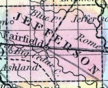
FAIRFIELD, a flourishing post-village, capital of Jefferson county, Iowa, on Big Cedar creek, about 50 miles W. by N. from Burlington. A plank-road has been commenced between this point and Burlington; and a railroad has been projected which will connect it with Keokuk. Fairfield is one of the most important towns in the interior of the state, and is the centre of an active trade.
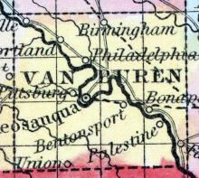
FARMINGTON, a thriving post-village of Van Buren county, Iowa, on the Des Moines river, about 30 miles N. W. from Keokuk, with which it is connected by a plank-road. It is the oldest village in the county, and is a shipping point for the produce of the vicinity. (Baldwin's New and Complete Gazetteer of the United States..., 1854)
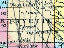
FAYETTE, a new county in the N. E. part of Iowa, has an area of 720 square miles. The Turkey river, an affluent of the Mississippi, is formed in the N. part by the union of its two main branches, and then traverses the N. E. part of the county; the South fork of the same stream drains the middle portion; the S. part is drained by Buffalo and other creeks.
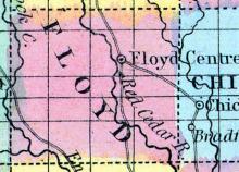
FLOYD, a new county in the N. N. E. part of Iowa, has an area of about 550 square miles. It is intersected by Cedar river, and also drained by Lime and Shellrock creeks, (branches of English river.) which unite in the S. W. part of the county. The slope of the county is south-eastward. It is not included in the census of 1850. County seat not yet located. (Baldwin's New and Complete Gazetteer of the United States..., 1854)
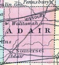
FONTANELLE, the county seat [Adair County, Iowa], is located a little southwest of the centre of the county, and is finely laid out on a beautiful prairie. It contains some fine public buildings, and has a population of about two hundred. The Methodists, Christians and Congregationalists, all have societies organized, but are as yet without church edifices. There is one newspaper, published weekly by James C. Gibbs. Fontanelle Lodge, No. 138, A. F.
FOREST CITY, the county seat [Winnebago County, Iowa], is situated on Lime Creek, in the south-eastern part of the county It contains one general store, blacksmiths, shoemakers' shops, etc. (Hair's Iowa State Gazetteer..., 1865)
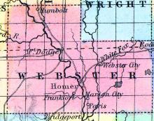
FORT DODGE, the county seat of Webster County, is situated in Wakonsa Township upon the east bank of the Des Moines River, called by the Sioux Indians Eah-sha-wah-pah-tah, Red Stone River, 200 miles west from DuBuque, on the line of railroad from DuBuque to Sioux City, and 80 miles north of Des Moines City.
FORT MADISON, a flourishing town, capital of Lee county, Iowa, on the Mississippi river, 12 miles above the head of the lower rapids, 22 miles above Keokuk, and 22 miles below Burlington. The situation is beautiful and healthful: the ground rising gradually from the water to the western part of the town. The latter is well built, with a large proportion of brick houses.
FRANKFORT is in the central portion of the county [Montgomery County, Iowa], and the county seat. The first settlers were John Burnside, Dr. Amasa Bond, Hon. A. G. Lowe, Samuel Baer, W. L. Boydston and Thomas Davis. Mr. Burnside was probably the “first settler,” as he brought water out of his well by a ladder, and ground his corn in a coffee-mill.
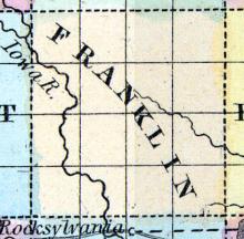
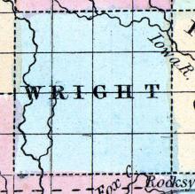
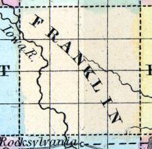
FRANKLIN COUNTY Is the fifth county west of the Mississippi River, and the third south of Minnesota, and is bounded on the north by Cerro Gordo county, on the east by Butler county, on the south by Hardin county, and on the west by Wright county.
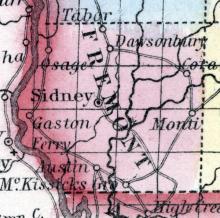
FREMONT COUNTY Is the extreme south-western county of the State. The first settlement was at Sidney, the county-seat, where the first sale of lots was made June 30th, 1851. James H. Cowles was the first resident. The present population of the county-seat is 300 — that of the county 3200.
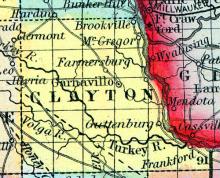
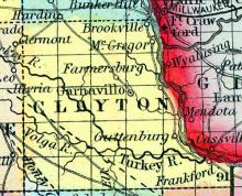
GARNAVILLO. or GARNAVILLE, a thriving post-village, capital of Clayton county, Iowa, on the mail route from Dubuque to Prairie du Chien, about 100 miles N. by E. from Iowa City. It is pleasantly situated on a high, rolling prairie. Lead is abundant in the vicinity. (Baldwin's New and Complete Gazetteer of the United States..., 1854)
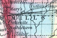
GLENWOOD, the seat of justice of Mills County, was so named by act of the General Assembly, approved 12th January, 1853, and the seat of justice also permanently located here. It was incorporated as a City by special act approved January 17, 1857, and has ever since preserved her city organization. It is most beautifully located a few miles west of the geographical centre of the county, in the valley of Keg Creek, surrounded by a growth of large timber.
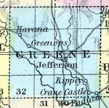
GREENE, a new county in the W. central part of Iowa, has an area of 600 Bquare miles. It is intersected by the Racoon river, an affluent of the Des Moines river. The county is mostly prairie ; the climate is healthy. It is not included in the census of 1850, and has but few inhabitants. County seat not yet located. (Baldwin's New and Complete Gazetteer of the United States..., 1854)
GRINNELL In the winter of 1853 and '54, there appeared a notice in the New York Independent and Tribune, by Rev. J. B. Grinnell, then a Congregational Minister in New York, of his purpose to form a Christian colony and locate in the west.
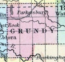
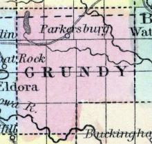
GRUNDY CENTRE, the county seat, is in the centre of the county [Grundy], on Black Hawk creek. It contains two general stores. The great drawback of the county is want of timber, but coal is found within twenty miles of this place. The village is fifteen miles south of the DuBuque & Sioux City Railroad, and twenty miles north of Marshalltown, on the Cedar Rapids & Missouri River Railroad. (Hair's Iowa State Gazetteer..., 1865)
GRUNDY, a new county in the N. E. central part of Iowa, has an area of about 500 square miles. It is drained by Black Hawk creek, an affluent of the Cedar river. This county is not included in the census of 1850, and the population is small. County seat not located. (Baldwin's New and Complete Gazetteer of the United States..., 1854)
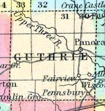
GUTHRIE COUNTY Is not as large nor as old as many other counties of the State, but possesses advantages which, when developed, will place her in the advance. The soil of Guthrie is second to none in the State, for the farmer, grazier, and fruit-grower.
GUTTENBURG, a thriving post-village of Clayton county, Iowa, on the Mississippi river, 40 miles above Dubuque. It has a good landing for steamboats. Large mines of lead are worked in the vicinity. (Baldwin's New and Complete Gazetteer of the United States..., 1854)
HAMPTON, the county seat [Franklin County, Iowa], is near the centre of the county, and situated on the north east quarter of section 33, T. 92, R. 20 W. It contains two general stores, a printing office, a fine flour mill, etc. The township consists of excellent tillable land, well watered, and drained by Otter Spring and Squaw Creeks. Good timber is furnished in considerable quantities by Van Horn's, Thorp's and Beed's Groves.
HANCOCK COUNTY Was organized in 1858, and is in the second tier of counties from the northern line of the State, and the sixth west of the Mississippi river. It is bounded on the north by Winnebago county, on the east by Cerro Gordo, on the south by Wright, and on the west by Kossuth.
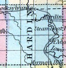
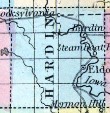
HARDIN COUNTY Was first settled in 1851, and contains a population of some 2000. The largest town in the county is Eldora, which is inhabited by some 15 families.
No churches erected yet — preaching by Cumberland Presbyterians and Methodists.
Well supplied with public schools in a good condition.
Coal abundant — timber more than an average. Red sandstone, and fine white limestone in abundance. Good prairie land — no better.
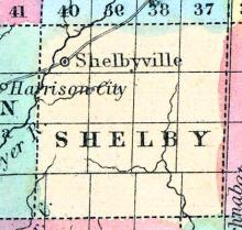
HARLAN, a small post village in the centre of the county [Shelby County, Iowa], on the Nishnabotany River is the county seat. (Hair's Iowa State Gazetteer..., 1865)
Note: Named county seat in 1859, succeeding Shelbyville, Iowa.
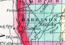
HARRISON, a new county in the W. part of Iowa, bordering on the Mississippi river, has an area of about 480 square miles. The Missouri river forms its W. boundary, and it is intersected by the Boyer and Soldier rivers. It is not included in the census of 1850, and the population is very sparse.
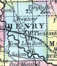
HENRY, a county in the S. E. part of Iowa, has an area of about 430 square miles. It [is] intersected by the Skunk river, an affluent of the Mississippi, and also drained by Cedar creek. The surface is generally undulating, the soil highly productive and easily cultivated. The greater part of the county consists of prairies, among which tracts of woodland are interspersed. Wheat, Indian corn, oats, potatoes, and grass flourish.
Early county seat of Webster County, Iowa before it was included in the split to the new county of Hamilton in 1856.
Part of Hamilton County, Iowa from 1856 to the present.

